
An exclusive report on a fly over of the Gulf of Mexico oil spill by visiting contributor Allie Wilkinson
 On July 3, I had the opportunity to join the Coast Guard on a C-130 Hercules fixed-wing aircraft during an oil observer surveillance flight. The flight was to depart from Coast Guard Air Station Clearwater, the largest and busiest air station in the Coast Guard, now made busier by the daily oil surveillance flights being conducted.
After arriving at the air station and having my credentials checked, I was soon joined by PA3 Robert Simpson, a public affairs officer with the Coast Guard. We waited for the remaining members of the media joining the 9 member flight-crew, before moving on to our mission and safety briefing.
 We boarded the C-130 and headed up the coast to Pensacola. Upon reaching Pensacola, we climbed from 1,000 feet to 17,500 feet. About 30 miles south of Pensacola, we saw the first ribbons of oil, something called transparent sheen. Sheen is a thin layer of fresh oil that may be transparent, rainbow, gray, or silvery in color. Transparent sheen, as the name implies, is one of the hardest to spot because it is the same color as the surrounding water. In the photo, ribbons of transparent sheen are visible just off the Chandeleur Islands, and resemble cat scratches on the water’s surface.

Anything from surface conditions to the position of the sun impact the spotters’ ability to detect oil on the surface. But the Coast Guard employs a range of tools to spot oil- eyes, cameras, radar, and infrared. MST 1 Aaron Hemme, a marine science technician, spent the entire flight at one of the aircraft’s two observation windows, armed with a GPS, camera, and clipboard to mark his observations. GPS location information is recorded of where the oil is, the type of oil, its color, and a description as to whether it is alight sheen or a heavier patty.

AET 2 Tanner Wooley, an avionics electrical technician, manned the radar from the flight deck, which can pick up oil on the water’s surface. Other members of the crew monitored CASPER. The CASPER (C-130 Airborne Sensor with Palletized Electronic Reconnaissance) system allows real-time, on-scene information to be uploaded to the Common Operational Picture, a geographic display tool that displays operational information.
The crew of the C-130 only gathers information, but does not process it. The data collected by the Coast Guard is shared with other agencies such as NOAA, as well as with BP and government officials. This information also allows officials to put coastal communities 72 hour notice prior to the oil’s expected landfall. The daily 4 to 6 hour flights conducted by the Coast Guard play an important role in tracking the spread of oil, which in turn helps those of us in the Gulf states prepare for the worst.
The Florida Department of Environmental Protection has set up a Twitter feed for alerts and releases situation reports daily that cover the weather, information on the spill response, state actions, and local states of emergency, as well as providing information websites and Florida information lines.
To keep up with the latest on the oil spill response and view situation reports for the Gulf states, check out the Deepwater Horizon Response page and follow the oil spill category here at DSN.

wow what an amazing experience to be able to see the oil spill areas and the damage it is doing to our waters, environment and eventually our marine life.
A flyover at 17, 000 feet? Wow, maybe if you get a little closer you could see the oil. Why so high, we wonder? Why not 2,000 feet off the deck? What exactly is the gov’t and BP hiding? No pictures, huh? And the Coast Guard is in on the fix…so much for guarding the coast, guys!
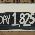
Go Allie! That sounds like a wonderful experience! Thank you for sharing that with us. It’s day 86 and there is no end in sight… it would be wonderful if more people could see the destruction first hand and maybe America would limit their use of petro products!
BP vs. the people takes place in New Orleans in Sept., that will tell the tale. Follow the money
We flew at 1,500 feet for part of the way up there, but then when we reached the Panhandle we ascended to 17,000 feet. I’m not sure why the different parts of the flight were conducted at different altitudes.
Thanks Grizzly Bear. I agree that it’s important for people to see images of the spill other than those of the really thick brown oil, especially when we are at a point where it is being reported that most of the oil is gone. Sometimes the oil is transparent sheen like in the photos above, and it makes it difficult for even trained spotters to locate- but it’s still there, it’s just dissipated.