
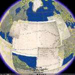
A sense of place. It’s essential to deep-sea exploration. We’re far from land, on a flat horizon, hovering over echosounder output from the seafloor below. We watch a map drawn line by line by line. It takes hours for small features, days for large ones. In time, different things are revealed to different people. Geological history unfolds in the minds of the geologists, habitats unfold for biologists. Then we dive to check our assumptions.
When we get home, the first decision is what to show you- the map, or the video. This is one reason I like Google Earth so much. It lets me do both. To be fair, Google Earth is not the only game in town for multimedia maps. Microsoft is offering a similar visualization platform through their Live Search Maps using NavTeq data in a BBC News story on Dam Construction in Ethiopia. Check it out. It flies!

Given, there’s no evidence of seafloor topography like you find in GE 5.0, but the interface is smooth. Zooming and panning are a breeze. The text and video are clear. The Ethiopian dam story makes me fear for the natural ecosystem, but there’s no denying that Live Maps could be a good platform for constrained area representation, visualizing expeditions on a regional scale, so long as seafloor topography’s not mission critical. If it is, you put it in a pop-up window. Sometimes we just don’t need the whole planet to tell our stories.
What do readers think? Google Earth vs Microsoft Virtual Earth. What works, what doesn’t?


Fact check: “Microsoft is offering a similar visualization platform through their NavTeq software”
Huh? Microsoft offer Virtual Earth, its mapping software platform which uses NAVTEQ data. Live Maps is the name of the end user Microsoft offering. NAVTEQ is owned by Nokia.
Not sure I understand this – “Live Maps is the name of the end user Microsoft offering.” Would it work if I adjust the text to remove the Navteq bit?
I lifted the title from the credits in the map. Never heard of Virtual Earth or Live Maps, but I’ll try to look into it.